In-Boundary Elementary School Neighborhoods that Stand Out
 In-Boundary Elementary School Neighborhoods that Stand Out
Description:
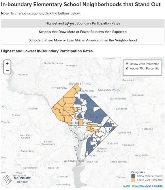
A gif of several maps of D.C. Public School boundaries. These maps highlight schools that stand out.
This map was created for the D.C. Policy Center article “Schools in the Neighborhood: Exploring the Data."
Details:
Maps created using the Leaflet library in JavaScript.
Simone Roy
Experienced Data Analyst
I am an experienced data analyst with experience in policy, research, and data visualization. I have a background in spatial data analysis and spatial data science.